Aqualink Cycling and Walking Corridor
The Aqualink Cycling and Walking Corridor (Aqualink) has been a long-term strategic vision for Moorabool Shire Council and the local community.
What is it?
Aqualink is a non-car-based transport option for the residents and visitors to Bacchus Marsh, and provide better access to the town’s main attractions and services.
Aqualink has been enabled by Southern Rural Water’s recent upgrade and modernisation project. New underground piping and the removal of the channel provides an opportunity to build a proposed off-road walking and cycling access and linkages through Darley and Bacchus Marsh. It will also link to an upgraded shared path from Bacchus Marsh Train Station to Main Street.
How will it be delivered?
Aqualink will deliver five sections of a proposed 4.5‑kilometre path network connecting the Lerderderg River and Werribee River corridors:
- Aqualink North (a): Lerderderg River to Holts Lane, Darley - COMPLETE
- Aqualink North (b): Holts Lane, Darley to Masons Lane, Bacchus Marsh - COMPLETE
- Aqualink Central: Masons Lane to Main Street, Bacchus Marsh - UNDERWAY
- Aqualink East: Main Street to Bacchus Marsh Train Station - COMPLETE
- Aqualink West: Masons Lane, Bacchus Marsh to Werribee River, Maddingley - UNFUNDED
For those living along the Southern Rural Water irrigation reserve, Aqualink will mean changes to your local area with new infrastructure or landscaping. Residents along the corridor may experience some impacts during construction, such as noise and dust.
We will continue to consult with nearby residents throughout the planning and construction work to minimise any potential impacts, and will notify residents of nearby properties before construction commences.
Progress so far
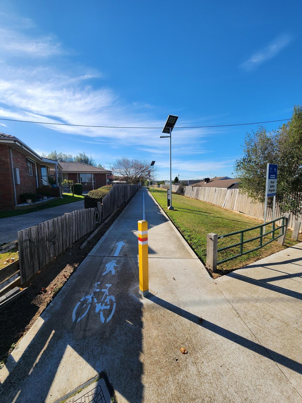
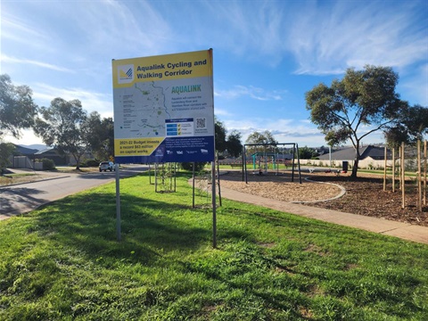
Aqualink North A - Holts Lane, Darley
Aqualink North A - Taylor Drive, Darley
Aqualink North B - Holts Lane, Darley
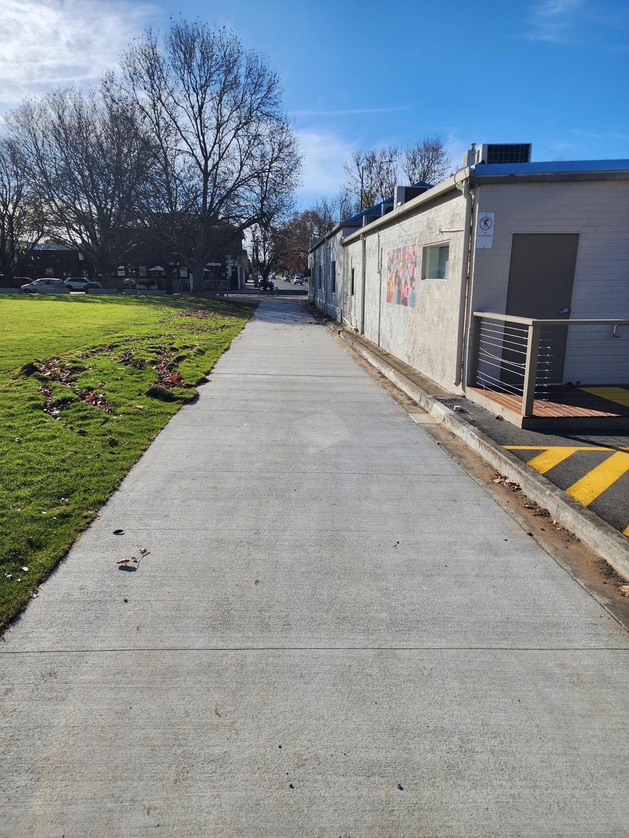
Aqualink Central - Main Street, Bacchus Marsh
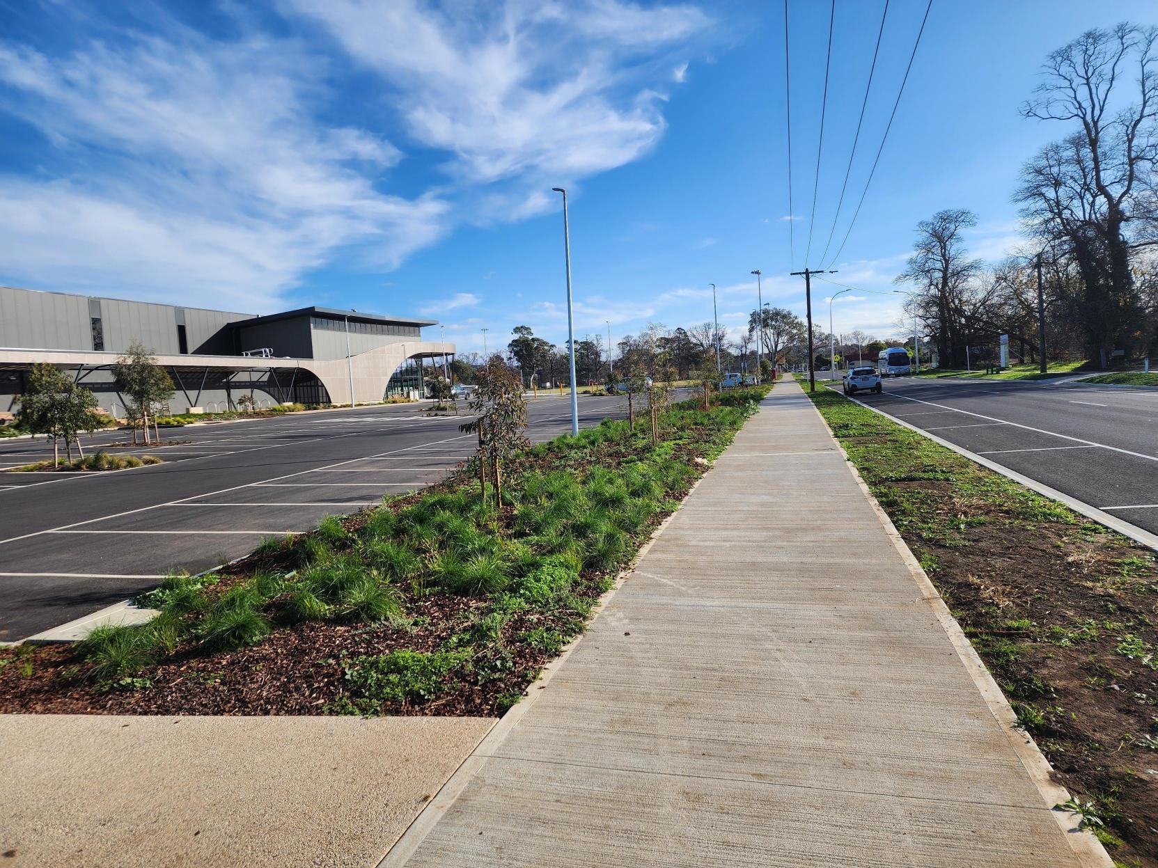
Aqualink East - Taverner Street, Maddingley
June 2024 Update
Aqualink North (A) - Lerderderg River to Holts Lane, Darley:
- Shared use path construction completed
- Lighting completed
- Landscape works for the general corridor completed
-Nodes: completed by end of June 2024
- Wayfinding in progress
Aqualink North (B) - Holts Lane, Darley to Masons Lane, Bacchus Marsh:
- Shared use path construction completed
- Lighting completed
- Landscape works to be procured
- Wayfinding in progress
Aqualink Central - Masons Lane to Main Street, Bacchus Marsh:
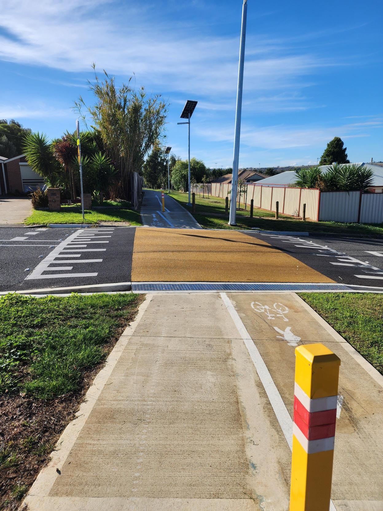
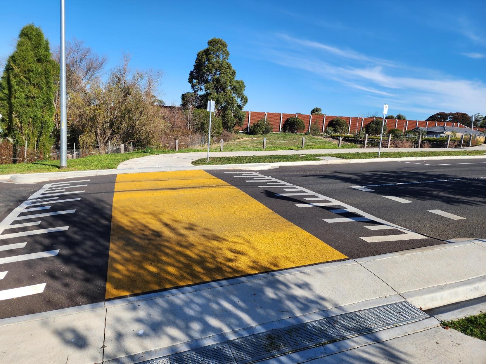
-Shared use path along Masons Lane completed
- Shared use path along Young Street unfunded
Aqualink East - Main Street, Bacchus Marsh to Bacchus Marsh Railway Station:
- Shared use path along Main Street carpark almost complete, with bollards required for this section.
- Shared use path from back of Main Street carpark to railway station complete.
- Lighting installation in progress
Aqualink West - Masons Lane, Bacchus Marsh to Werribee River, Maddingley:
- The final stage of the Aqualink project has not yet been funded. It is a high priority in Council's Advocacy Prospectus. To view it and other projects, click here
FAQs
1. What is Aqualink?
The Aqualink Cycling and Walking Corridor (Aqualink) will be made up of four sections of a new 4.5 kilometre path network connecting the Lerderderg River and Werribee River corridors.
It will deliver a new, non-car-based transport option for the residents and visitors to Bacchus Marsh and provide better access to the town's main attractions and services. Aqualink has been enabled by Southern Rural Water's recent upgrade and modernisation project, which included underground piping of the open channel irrigation supply.
2. Where is the project located?
Aqualink will include a new 4.5-kilometre shared path connecting the Lerderderg River and Werribee River corridors through Bacchus Marsh and Darley.
Aqualink will also link to an upgraded shared path from Bacchus Marsh Train Station to Main Street which is currently under construction.
The general alignment of the pathway will be situated along the existing Southern Rural Water irrigation reserve. Over recent years Southern Rural Water has completed a major upgrade and modernisation project which included underground piping of the open channel irrigation supply. With the channel removed the reserve provides an opportunity to provide off road access and linkages through Darley and Bacchus Marsh.
3. Why is this project happening?
Aqualink is identified as a key as part of Moorabool’s extended cycle network and by the Department of Transport as the primary route of the Strategic Cycling Corridors for Bacchus Marsh. The Bacchus Marsh community is supportive of Aqualink and has advocated for improved cycling linkages through the area.
Aqualink has been a long-term strategic vision for Moorabool Shire Council and the local community and is supported by various Council strategic documents including:
- Recreation and Leisure Strategy
- Bacchus Marsh Integrated Transport Strategy
- Recreation Reserves Management Framework 2015-21
- Health and Well-being Plan 2017-21
- Municipal Early Years Plan 2015-21.
- Bacchus Marsh Urban Growth Framework
- Bacchus Marsh & Ballan Open Space Framework
The project has been enabled by Southern Rural Water’s recent upgrade and modernisation project, which included underground piping of the open channel irrigation supply.
4. Who owns the land that Aqualink will be built on?
Southern Rural Water is the landowner for the north and west section of the project.
Southern Rural Water is a water corporation under the Victorian Government’s Department of Environment, Land, Water and Planning and is responsible for managing irrigation districts, the regulation of surface water and groundwater licensing, and storage dams across Moorabool Shire Council.
5. When will construction start and how long will it take?
Aqualink will be delivered in the following sections:
- Aqualink North (a): Lerderderg River to Holts Lane, Darley
- Aqualink North (b): Holts Lane, Darley to Masons Lane, Bacchus Marsh
- Aqualink Central: Masons Lane to Main Street, Bacchus Marsh
- Aqualink East: Main Street to Bacchus Marsh Train Station
- Aqualink West: Masons Lane, Bacchus Marsh to Werribee River, Maddingley
Funding from the Federal and State Government for the construction of the shared path is subject to conditions which means that the project is progressing quickly.
Aqualink East is expected to begin after Easter 2021 and is scheduled to be completed by July 2021. Construction on Aqualink North (a) will only commence once finalised formal agreements with Southern Rural Waters.
6. Who will be responsible for construction?
Construction will be undertaken by contractors.
Council has procured construction contractors to deliver the path.
7. I am a neighbouring resident. Who can I speak to?
We are consulting with nearby residents throughout the project to minimise impacts of construction. A letter has been sent to nearby residents to introduce the project.
We encourage residents to get in touch and provide their email address or phone number. This will allow us to get in touch more quickly with project updates.
We will notify residents of nearby properties two weeks before construction commences.
You can get in touch with the project team by calling Council on (03) 5366 7100 or by email to Aqualink@Moorabool.vic.gov.au.
8. Where can I found out more about the project?
To find out more about the project or upcoming engagement opportunities, you can get in touch with the project team by:
9. How is the project being funded?
Moorabool Shire Council is excited to receive funding from the Federal Minister for Infrastructure and the Victorian State Government for the delivery of the Aqualink Cycling and Walking Corridor project.
In total, council received approximately $3.6 million to contribute to Aqualink.
We look forward to working with Southern Rural Water and the Department of Transport in the delivery of this project.
Funding
This project will be delivered with funding from the Federal and State Government. The Department of Transport, Southern Rural Water and Moorabool Shire Council are working together to deliver this project. A further $4.1 million grant was received from the Federal Road Safety Program.